

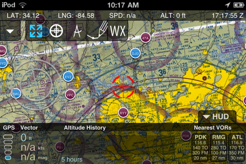
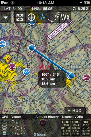
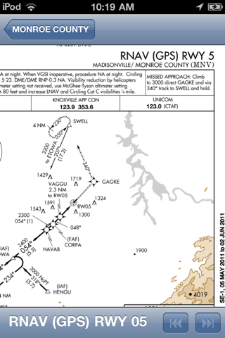

FlightKit is an all-in-one tool for general aviation. It includes all VFR sectional and TAC charts with sophisticated overlays for airport/navaid info, route planning, and airspace. A/FD and plates are available for airports. Charts are cached locally for offline use, and plates are cached after theyre viewed. A drop-down HUD shows current speed, heading, and altitude along with a customizable altitude history graph and vectors to the three nearest VORs. Switch the chart into 3D mode to visualize restricted airspace in three dimensions.
FlightKit is free to download and includes a 15 day subscription. Additional subscriptions may be purchased in the app.